Hobart Cycling Paths Guide
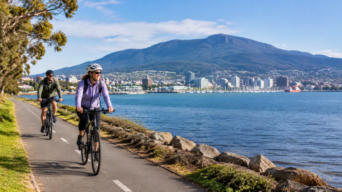
Hobart’s easiest cycling follows the Intercity Cycleway and Hobart Rivulet Track, while the Pipeline Track offers a longer bush ride away from city traffic. These routes serve different riders, so the best choice depends on your starting point, bike and comfort near cars. Hobart also has steep streets, short gaps between paths and fast-changing weather. A good route plan matters more here than raw distance.
This Hobart cycling paths guide explains how the main routes connect, where road sections may be required and which rides suit transport or recreation. It also covers hills, surfaces, Road safety and Bicycle parking. The aim is to help you choose a ride that matches your skills before you leave.
Which path is the best place to start?
The Intercity Cycleway is the simplest starting point for most riders. It follows a former railway corridor north from central Hobart through Moonah and Glenorchy, Tasmania, towards Claremont. Much of the route is separated from motor traffic, its grades are easier than the surrounding streets and there are regular places to leave or join it.
This makes the cycleway useful for commuting, family rides and visitors who want a clear route. It also passes shops, recreation areas and public transport stops. Road crossings still need care, especially where drivers turn across the route or enter side streets.
The Hobart Rivulet Track suits a shorter ride close to the centre. It runs inland beside the Hobart Rivulet towards South Hobart. The setting shifts quickly from city edges to a greener corridor beneath kunanyi/Mount Wellington. It is useful for a relaxed outing, although its surface and width can vary.
The Pipeline Track is the better choice for a longer bush ride. It follows the historic water pipeline across the slopes below kunanyi/Mount Wellington. Its broad corridor and gentle overall grade make it more approachable than many steep mountain trails. Access still involves climbing from lower Hobart or carrying the bike by vehicle to a suitable entry point.
Choose by purpose:
- Use the Intercity Cycleway for a steady urban ride with few steep climbs.
- Use the Hobart Rivulet Track for a short trip near the city and South Hobart.
- Use the Pipeline Track for forest scenery and more time away from traffic.
- Use local streets only after checking gradients, junctions and the return route.
How does the Intercity Cycleway work for everyday travel?
The Intercity Cycleway is the strongest spine in Hobart’s Cycling infrastructure. It gives northern suburbs a direct route towards the waterfront and central business district. Riders can join from Moonah, New Town, Derwent Park, Glenorchy and areas farther north.
The railway alignment keeps climbs modest compared with roads running across the foothills. That difference is easy to miss on a map. Two routes may cover the same distance, yet the route that crosses Hobart’s slope can demand far more effort. Staying on the cycleway for longer often saves energy even when it adds a small detour.
The path is shared. People walk dogs, children may change direction and commuters can approach quickly from behind. Keep left, slow near busy access points and ring a bell before passing. A shared path is safer when speed matches the space available.
The southern end brings riders towards busier streets and waterfront activity. Do not assume that a continuous line on a digital map means full separation at every point. Check the final blocks before leaving, especially if you are travelling to a workplace, ferry point or hotel.
For a first ride, start with an out-and-back trip. Turn around while the distance still feels easy. This removes pressure to find an unfamiliar connection when tired and lets you inspect crossings from both directions.
What should riders expect on the Hobart Rivulet corridor?
The Hobart Rivulet corridor offers a useful link between the city fringe and South Hobart. The Hobart Rivulet Track follows sections of the waterway through a narrow urban valley. It feels sheltered in places, but it is still a shared route with walkers, dogs and local access points.
This is a good option for riders who want a short trip without committing to a long northern route. It can also form part of a journey towards the foothills. The track should not be treated as a seamless high-speed commuter lane. Narrow sections, changing surfaces and limited sight lines call for a slower pace.
Rain can change the ride. Wet leaves, loose grit and shaded corners reduce grip. The rivulet can also rise after heavy weather. Follow closure signs and turn back if water or debris covers the path. Riding around a barrier can place you on an unstable edge with no safe escape line.
At road connections, pause before entering traffic. South Hobart has narrow streets and parked cars can hide approaching vehicles. Drivers may also fail to see a bicycle leaving a path entrance. Make eye contact where possible and enter only when the lane is clear.
A hybrid bike, commuter bike or mountain bike suits the mixed conditions. A road bike can work in dry weather, but narrow tyres give less comfort on rough or loose patches.
Is the Pipeline Track suitable for casual riders?
The Pipeline Track suits casual riders who can handle an unsealed surface and plan their access. The track follows a contour through forest, so much of the riding is gentler than the steep roads below it. The setting feels remote even though parts remain close to Hobart.
This route is different from technical Mountain biking. It does not demand the same skills as narrow singletrack with jumps, rock drops or sharp turns. Riders still need control on gravel, enough fitness for the chosen distance and working brakes for the return.
The main issue is reaching the track. Fern Tree and nearby access points sit well above central Hobart. Riding up can turn an easy track ride into a hard climbing day. A hypothetical visitor who plans a flat forest outing but starts from the waterfront may spend most of their energy before reaching the route. Checking elevation prevents that mistake.
Weather near the mountain can be colder and wetter than conditions in the city. Carry a warm layer and water, even on a mild morning. Mobile reception may vary, so save the route offline. Tell someone where you plan to enter and when you expect to return.
Respect walkers and runners. Slow before blind bends, keep left where the surface allows and avoid skidding. Hard braking loosens the track surface and makes future rides rougher.
Can you ride comfortably around central Hobart and Battery Point?
You can ride in central Hobart, but comfort changes from street to street. The waterfront has useful low-speed areas and path links. Inner streets can place riders beside parked cars, turning vehicles and buses. Painted lanes do not provide the same protection as a separated path.
Battery Point rewards slow riding rather than direct riding. Its historic street pattern includes narrow roads, short climbs and busy visitor areas. Salamanca activity can also increase foot traffic and vehicle movements. Pick quieter streets, expect to stop often and walk the bike where crowds leave too little space.
Watch the door zone beside parked cars. Ride far enough out to avoid an opening door when lane width permits. At intersections, avoid sitting beside a large vehicle that may turn across your path. Taking a clear lane position can make you more visible, but only do so when you can hold a steady line and local traffic conditions allow it.
Hobart’s one-way streets and steep cross streets can make a direct route awkward. A route planner set to cycling mode may find a legal option, yet it cannot judge your comfort near traffic. Compare the suggested line with satellite views, elevation and current council notices before relying on it.
How well do the paths serve Kingston and southern Hobart?
Kingston, Tasmania has local shared paths and cycling links, but it does not connect to central Hobart through one continuous traffic-free route. The Southern Outlet is a major barrier for many casual riders. Nearby roads may be steep, narrow or busy, so a route that looks short can feel demanding.
Riders travelling within Kingston should plan around local destinations rather than assume the northern Intercity Cycleway model applies. Check whether each section uses a shared path, painted lane or ordinary road. Pay close attention to roundabouts and shopping-area driveways.
A trip between Kingston and Hobart requires more care than a ride along the Intercity Cycleway. Strong riders may use road routes, but families and people new to traffic should not treat the journey as a simple path ride. Combining cycling with a bus may be the more practical option when bicycle carriage rules and available space suit the trip.
The wider lesson is that Hobart’s network works as connected pieces rather than one complete web. The best trip often joins a major path to carefully chosen local streets. Check every gap before leaving instead of discovering it at a fast junction.
What Road safety issues matter most in Hobart?
Visibility, hills and changing path conditions deserve the most attention. Hobart’s low winter sun can make riders hard to see. Use front and rear lights during dull weather and around dawn or dusk. Bright clothing helps, but lights provide a clearer signal to approaching drivers.
Descents create another risk. A steep street can build speed much faster than expected. Brake before a corner, scan for gravel and leave space for a car to emerge from a driveway. Test both brakes before starting a mountain or foothill ride.
At shared crossings, confirm that drivers have stopped. A green signal or marked crossing does not prove that a turning driver has seen you. Slow enough to stop and watch the vehicle’s wheels for movement.
Tasmania’s road rules apply to bicycles, and equipment requirements can change. Check current guidance from the Tasmanian Government before riding. Wear an approved helmet, use the required lights and reflectors, and follow signs that limit bicycle access. On paths, give way as signed and pass other users with room.
Carry a basic repair kit on longer routes. A spare tube, tyre levers, pump and suitable multi-tool cover common faults. Know how to remove a wheel or arrange pickup before heading onto the Pipeline Track.
Where can you leave a bike securely?
Bicycle parking quality varies across Hobart. Public hoops appear near many central destinations, but availability may be limited during busy periods. Secure the frame and at least one wheel to a fixed stand with a strong lock. Remove lights, bags and other loose items.
For a longer stop, ask the venue or accommodation whether it has indoor storage. A rail or fence may look convenient but can block access, damage property or breach local signs. Never lock a bike to emergency equipment, trees or a narrow handrail used by pedestrians.
E-bike riders should remove the display or battery when the design allows. Do not leave an e-bike charger running in a public area without permission. If you plan to park after dark, choose a visible place with regular foot traffic rather than an isolated corner.
The safest plan is to confirm parking before the ride. This matters around markets, events and busy waterfront periods, when the nearest rack may already be full.
How should you plan a first Hobart ride?
Start with distance, elevation and surface. Then inspect every point where the route leaves a path. The The Hobart Field Guide can help place a ride within a wider day in Hobart, but current route conditions should come from official council or government notices.
- Choose one main path that suits your bike and confidence.
- Save the map offline and mark path entrances, road gaps and turnaround points.
- Check weather near both the city and kunanyi/Mount Wellington if riding uphill.
- Pack water, a repair kit, a lock and clothing for a cooler return.
Allow more time than the map estimate. Shared paths require slower passing, while photo stops and road crossings add minutes. If your route climbs on the outward leg, remember that the descent may be colder and demands more braking control.
Choose one route, inspect every road gap and ride it as an out-and-back trip before attempting a longer Hobart connection.