Knocklofty Reserve Walking Guide
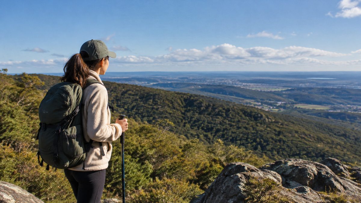
Knocklofty Reserve is best explored as a steady uphill circuit from West Hobart, with the summit area as the main goal and a different track used for the return. The reserve sits close to central Hobart yet feels separate from the streets below. Its connected tracks cross dry Bushland, open Woodland and steeper slopes around Knocklofty Hill. Allow about 60 to 90 minutes for a useful first walk, or longer if you want to explore side tracks and stop at the viewpoints.
The reserve rewards simple planning. Pick an entrance that suits your starting point, check the official map at the trailhead and expect the climb to feel harder than the distance suggests. The tracks rise quickly from the surrounding suburbs, so footwear, water and route choice matter more here than they do on a flat city walk.
Which entrance gives you the simplest start?
The best entrance is the one that avoids an unnecessary road climb before you enter the reserve. Most walkers approach from West Hobart or Mount Stuart, where local streets meet tracks on the lower slopes. Access is also possible from streets near the southern side, which can suit people coming from South Hobart.
There is no single grand arrival point with a visitor centre and large formal car park. Knocklofty works more like a neighbourhood reserve with several access points. That makes it convenient for local walks, but first-time visitors should confirm their chosen entrance before leaving. Search for the exact access point rather than asking a map app to route you only to “Knocklofty Reserve.”
If you are driving, pay close attention to street signs and private driveways. Residential parking is limited near some entrances. Do not assume there will be a free space beside the track. If you are walking from central Hobart, remember that the approach itself climbs through West Hobart. Save some energy for the reserve.
Visitors using public transport should check the current Metro Tasmania timetable and walk from the nearest practical stop. Services and stop locations can change. The final approach will usually involve suburban streets and an uphill section.
What route works well for a first visit?
A first visit works best as a loop that climbs towards Knocklofty Hill, passes through the upper reserve and returns by another marked Trail. This gives you changing views and avoids retracing the whole route. Use the trailhead map to identify a clear upper goal, then note the junctions needed for the return.
Begin on a broad, obvious track where possible. Settle into a pace you can keep during the climb. At each junction, check the sign, map or saved location before turning. The reserve contains many linked tracks, and a path that appears to run parallel can descend towards a different suburb.
The upper slopes are the natural focus of the walk. Open sections reveal the shape of Hobart below, with the River Derwent and surrounding hills visible when weather and vegetation allow. The view changes as you move, so a circuit offers more than a direct climb followed by the same descent.
A hypothetical first-time route might take 20 to 35 minutes to climb, allow time near the upper area, then use a gentler track for the return. That timing is a guide rather than a promise. Your entrance, pace and choice of side tracks will change the total.
How hard is the walking?
The main difficulty is sustained climbing on uneven Terrain. Many sections are manageable for regular walkers, but the reserve should not be treated like a paved city park. Loose gravel, embedded rocks, exposed roots and washed surfaces can appear on the tracks. Steeper shortcuts demand more care than the broad management tracks.
The uphill work begins early from several entrances. A person who walks often on level ground may still need short rests. The descent can place more strain on knees because loose material reduces grip. Take smaller steps, keep your weight controlled and leave space between walkers.
Dry conditions can make dusty corners slippery. Rain may leave soft ground, puddles or small channels where water has cut through the surface. After bad weather, use the firmer main routes and avoid widening muddy sections by walking around them.
Fitness matters less than pace. Start slowly enough that you can speak in full sentences. If the climb becomes uncomfortable, turn at a clear junction and follow the same route back. There is no need to reach the highest point for the walk to be worthwhile.
What will you see in the reserve?
Knocklofty protects a sizeable patch of native vegetation beside the city. The setting shifts between open Woodland, denser pockets of Bushland and cleared viewpoints. Dry forest plants suit the sunny slopes and lean soils found across this part of Tasmania.
Bird activity is often easier to notice away from busy entrances. Slow down near flowering shrubs and listen before moving on. Small animals may also use the track edges, especially during quieter parts of the day. Observe wildlife from a distance and keep food packed away.
The reserve also shows how closely Hobart’s suburbs meet the bush. From one section you may see rooftops in Mount Stuart. Higher up, the city and river take over the view. Turn around during the climb because some of the best outlooks sit behind you rather than at a signed lookout.
The vegetation is part of the experience, not empty space between viewpoints. Staying on formed tracks limits trampling and helps protect smaller plants. It also reduces the spread of soil and weed seeds into less disturbed areas.
When should you walk?
Choose a cool, clear period with enough daylight to finish before dusk. Morning often gives comfortable climbing conditions and quieter tracks. Late afternoon can bring softer light across the city, but it leaves less time to correct a wrong turn.
Tasmania’s weather can change quickly. A mild start does not guarantee a dry or warm finish. Check the Hobart forecast before leaving and look for strong wind, rain, heat or fire warnings. On warm days, exposed slopes can feel much hotter than shaded streets below.
Winter brings shorter daylight hours and colder wind on open ground. Recent rain can make descents slower. Summer demands more water and sun care. During periods of high fire danger, follow official advice and obey any reserve closure or access notice.
Do not rely on city lights to guide you after sunset. Tree cover, bends and multiple junctions can make orientation harder once the light fades. Carry a charged phone, but treat it as a backup rather than your only plan.
What should you carry?
Wear shoes with firm grip and take drinking water. A light layer is useful even when the streets below feel warm. Sun protection matters on open slopes, while a compact rain layer helps when the forecast is unsettled.
A downloaded map or screenshot is useful because phone reception and map detail should never be assumed. Mark your entrance before starting. If you take an unplanned side track, knowing where you entered makes the return much easier.
Carry any food wrappers and dog waste out with you. Bins may not stand beside every entrance or junction. A small bag keeps litter contained until you reach one.
For a longer walk, tell someone which entrance you will use and when you expect to return. This is a suburban reserve, but falls, heat and poor route choices can still cause trouble. Simple preparation solves most of those problems.
Can children, dogs or bikes use the tracks?
Families can use Knocklofty, but adults should match the route to the least confident walker. Broad lower tracks may suit capable children better than steep, narrow links. Keep children close at junctions and on descents where loose gravel can cause falls.
Dog access rules can vary by section, track or wildlife need. Read the signs at your entrance and follow the current City of Hobart rules for that area. Carry a lead even if part of your planned route permits dogs off lead. Other walkers, wildlife or a change in track conditions may require immediate control.
Cyclists also use parts of the reserve. Walk predictably, keep to one side when safe and listen for riders approaching from behind. Cyclists should slow near walkers and blind corners. No user has a clear view through every bend.
People using prams, wheelchairs or mobility aids should not assume the circuit is accessible. The gradient and natural surfaces create barriers. Check current access information and inspect the lower approach before committing to a longer route.
How do you avoid getting lost at the junctions?
Build the walk around fixed points rather than trying to remember every bend. Your entrance is the first point. A signed upper destination is the next. Your chosen return junction completes the loop.
Photograph the map at the entrance. At an unsigned or unclear fork, stop before choosing. Compare the direction of travel with the slope and your saved map. If the path begins dropping towards the wrong suburb, return to the last junction you recognised.
Do not follow another walker on the belief that they are taking the same route. Local walkers may be using a short connection to Mount Stuart, West Hobart or South Hobart. Their destination may be a home street rather than the upper reserve.
Track names and conditions can change after maintenance. Signs on site should guide the final choice. Where a closure blocks your planned loop, use the marked alternative or return the way you came.
What mistakes make the walk harder than it needs to be?
Starting too fast is the most common mistake. The early climb can use more energy than expected, leaving little control for the descent. A steady pace keeps the walk comfortable.
Another mistake is choosing every narrow side path because it appears to offer a shortcut. Shorter lines are often steeper and may finish at an unfamiliar street. Stay with the planned circuit on your first visit.
Relying on total distance can also mislead. A short route over steep, loose ground may take longer than a flat walk of twice the length. Plan by time, Terrain and daylight rather than kilometres alone.
Some visitors focus only on reaching the top. That rush misses the changing forest, city views and quieter sections that make the reserve worth walking. Pause where the track is wide enough for others to pass, then move on without blocking the route.
How can you leave the reserve in good condition?
Stay on established tracks, take rubbish with you and obey closures. Closures may protect damaged surfaces, restoration work or public safety. Cutting around a barrier creates new erosion and slows repairs.
Clean soil and seeds from footwear before and after the walk. This reduces the chance of carrying weeds or plant disease between natural areas. The step takes less than a minute and matters in reserves connected to urban gardens and roadsides.
Keep noise low near wildlife and nearby homes. Knocklofty is both a natural area and part of a residential neighbourhood. Respect for both helps preserve easy public access.
What is the simplest plan to follow?
- Check the Hobart weather, daylight and any City of Hobart reserve notices.
- Choose one named street entrance and save its position on your phone.
- Follow a broad marked route towards the upper reserve at a steady pace.
- Use a different signed track for the return only when you can confirm it reconnects with your entrance.
- Turn back early if heat, fading light, poor footing or uncertain navigation makes the loop unsafe.
For more independent ideas around the city, use The Hobart Field Guide, an independent publication covering practical ways to explore Hobart.
Take one action: save your chosen Knocklofty entrance and return route before you leave.
From Mount Stuart, Tasmania, Knocklofty Reserve offers a convenient setting for a walk through bushland, with tracks that suit a range of routes and timeframes.