Mount Nelson Signal Station Walk
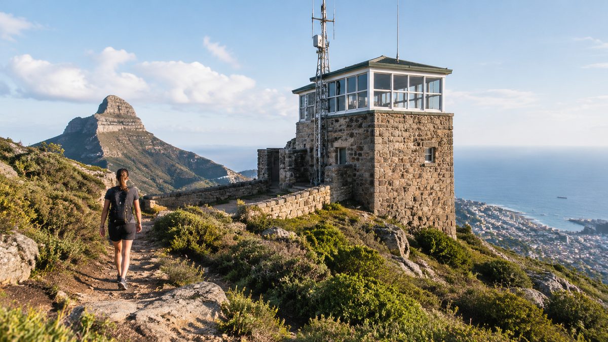
The Mount Nelson Signal Station walk is either a short summit visit or a steep bush climb from Sandy Bay, depending on where you start. Drive to the signal station for an easy stroll around the lookout and historic site. Start from Cartwright Reserve if you want the longer Truganini Track, which climbs through native Bushland to the same summit. Both options end with broad views across Hobart, the River Derwent and the hills beyond the city.
The two experiences are easy to confuse. Signs and maps may refer to the signal station, the reserve or the Truganini Track. The summit option needs little walking. The lower route is a real hill walk with a sustained climb, rough ground and road crossings. Choose your start based on the walk you want rather than treating the routes as equal.
Which starting point gives you the walk you want?
Use the signal station car park on Nelson Road if your main aim is the historic site and lookout. The paths near the summit are short, and the main viewing area sits close to the parking area. This choice suits a brief stop, visitors with limited time and people who do not want a long climb.
Use Cartwright Reserve in Sandy Bay for the full walking approach. The Truganini Track rises from the lower slopes of Mount Nelson through dry forest before reaching suburban streets near the summit. It then continues towards the signal station. This route turns the lookout into the reward at the end of a demanding ascent.
The lower start also changes how you understand the hill. From the summit, Mount Nelson can feel like a roadside viewpoint. On foot, its height becomes clear as the track leaves the lower suburbs and gains ground through the reserve. The shift from enclosed forest to open river views gives the walk its shape.
Check current City of Hobart track information before leaving because closures, maintenance and fire conditions can affect access. The The Hobart Field Guide can help place the walk within a wider Hobart visit, but council notices should guide same-day access decisions.
How demanding is the climb from Sandy Bay?
The Truganini Track is steep enough to feel like exercise rather than a casual park stroll. Expect a steady uphill effort, uneven surfaces and sections where loose gravel or damp ground can reduce grip. The return descent may feel harder on knees than the climb feels on lungs.
Allow more time than the map distance alone suggests. Elevation, road crossings and pauses at track junctions slow the trip. A fit walker may complete the climb and return in a few hours, while families and less regular walkers should leave a wider margin. Turning the outing into a one-way walk requires a planned lift or public transport connection rather than an improvised finish.
Walking boots are optional in dry weather, but shoes need firm soles and reliable grip. Carry water because a shaded track can still become warm on a clear day. Sun protection matters near the top, where the route becomes more exposed. A light layer is useful because wind at the signal station can feel much cooler than conditions in Sandy Bay.
People often judge a route by its highest point and assume the return will be simple. On this walk, tired legs meet the loose downhill surface. Keep some energy for the descent, shorten your stride and slow down before steep corners.
How do you follow the route to the summit?
From Cartwright Reserve, follow signs for the Truganini Track and Mount Nelson. The track climbs through the reserve, then meets the street network on the upper slopes. This is not a continuous remote trail. The route mixes natural track with suburban connections before the final approach to the signal station.
Pay close attention where the track reaches roads. Look for the next marker before walking on, and do not assume the route continues directly opposite every exit. Online mapping can be useful, but a saved council map is more dependable than mobile reception or an app designed mainly for roads.
Road crossings deserve the same care as the steep ground. Stop, check both directions and keep children close. Drivers may not expect walkers to appear from a track entrance. After rain, allow extra space when stepping off a muddy verge onto a hard road surface.
At the upper end, follow the marked connection towards the signal station rather than choosing an unsigned shortcut through vegetation. Informal paths widen erosion, damage plants and can lead to private property. Remaining on the formed route also makes the return easier to recognise.
What makes the signal station more than a lookout?
Mount Nelson once formed part of Tasmania's colonial signalling system. Its position above the Derwent gave observers a wide view of vessels moving towards Hobart. Staff could pass news about approaching ships before those ships reached the waterfront.
Early signalling used flags, while later systems used Semaphore. A semaphore mast sent coded messages through the position of its arms. Stations relayed those messages from one visible point to the next. This turned separate hilltops into a chain of Communication at a time when sending a rider overland took far longer.
The network eventually linked Hobart with distant stations, including the penal settlement at Port Arthur, Tasmania. Messages moved along the line through repeated observation and transmission. Weather, visibility and human accuracy still shaped how well the system worked. Fog or low cloud could interrupt a chain even when every station was staffed.
This history is easier to grasp from the summit. The open sightlines were working infrastructure. Look down the river and imagine each station needing a clear visual link with the next point. The location then reads as a practical choice, not simply a scenic one.
Why is the lower track named after Truganini?
The Truganini Track carries the name of Truganini, a Nuenonne woman from Bruny Island whose life was shaped by British invasion, violence and forced movement. She lived during a period of severe harm to Aboriginal communities across lutruwita/Tasmania.
Her name is often attached to simplified claims that she was the last Tasmanian Aboriginal person. That claim is false and erases the survival of Tasmanian Aboriginal people, families and culture. Walkers should understand the track name without repeating that damaging story.
A trail name cannot tell the full history of one person or the Aboriginal history of the mountain. It can prompt better questions about whose land a route crosses, how colonial Hobart expanded and why some public accounts have reduced complex lives to a single label. Treat the name as a reason to seek reliable Aboriginal-led history rather than as a complete explanation.
What can you see along the way?
The lower route passes through dry eucalypt Bushland typical of Hobart's warmer slopes. The experience changes with height and weather. Enclosed sections place the focus on trunks, leaf litter and the sound of birds. Open points reveal parts of Sandy Bay and the Derwent below.
At the summit, the view extends across the river and urban Hobart. Conditions decide how much detail is visible. A clear day can reveal distant ridges and settlements, while low cloud may hide the higher country but leave the river open. Morning and late afternoon often produce softer light, though the safest time is the one that leaves enough daylight for your whole route.
Walk quietly and watch the edges of the track. Native birds may be easier to hear than see in dense foliage. Wildlife can also appear close to the path around quieter periods. Observe from a distance, keep food packed away and never push through vegetation for a photograph.
The summit can be colder and windier than the starting point. Tree movement, fast cloud and a sudden fall in temperature are useful warnings. If conditions worsen, shorten the stop and begin the descent while the route remains easy to see.
Can children manage the walk?
Children who already handle steep bush tracks may enjoy the full climb, but the summit visit is the better choice for younger children or families seeking a low-effort outing. The lower route asks children to manage sustained climbing, uneven ground and suburban road crossings.
Adults should set a turnaround time before starting. That removes pressure to reach the top after the group becomes tired. Carry enough water for each walker and keep snacks sealed until a safe stopping place. Children should stay within sight because side tracks and road exits can create confusion.
A useful family plan is to have one adult drive to the summit while the others walk up, provided transport and supervision are arranged before departure. This avoids making tired children descend the steep route. Do not rely on finding an available ride after reaching the top.
What conditions can change the walk?
Heat, rain and fire danger can turn a manageable climb into a poor choice. Dry forest offers shade in places, but it does not remove heat risk. On hot days, start early or choose the short summit visit. During severe fire weather, check official warnings and avoid entering Bushland when authorities advise against it.
Rain makes rocks, roots and compacted soil slippery. It can also hide holes under wet leaves. After heavy rain, take the descent slowly and avoid track edges where soil may give way. If strong wind is moving branches above the track, postpone the forest section.
Daylight is another firm limit. The track can become difficult to read at dusk, especially where it meets streets. Work backwards from sunset and allow spare time for stops. A charged phone and saved map support good planning, but neither replaces an early start.
What should you bring and leave behind?
Carry water, sun protection, a weather layer and a saved route map. Add any personal medicine you may need. For the longer climb, a small first-aid kit is sensible. Pack all rubbish out because bins may not be available where you stop.
Leave speakers at home. Loud audio affects wildlife and other walkers. Keep voices low near homes on the upper route. If dogs are permitted under current reserve rules, obey the posted leash controls and remove all waste. Rules can change between tracks, so read signs at the entrance rather than relying on an old online comment.
Do not remove plants, rocks or objects from the historic site. Avoid touching or climbing on signal equipment and heritage features. The station's value comes from its setting and surviving fabric, both of which suffer when visitors treat them as props.
How can you build a simple plan for the day?
- Decide whether you want the summit stroll or the full Truganini Track climb.
- Check weather, fire warnings and current City of Hobart track notices.
- Save the route and arrange return transport if you plan to walk one way.
- Set a turnaround time that leaves a clear daylight margin.
For a short visit, park at the signal station, read the interpretation and study the sightlines that made visual Communication possible. For the full walk, begin at Cartwright Reserve with enough time and water for a steep return. Avoid adding an unplanned extension after reaching the top, since fatigue tends to become clear during the descent.
Choose your starting point before you leave: use the summit car park for an easy historic visit, or Cartwright Reserve for the full steep walk.