Hobart Waterfront Walking Route
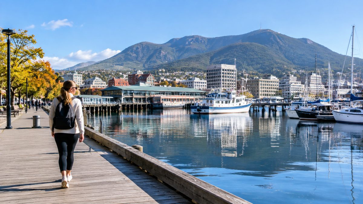
The best Hobart waterfront walking route runs from Salamanca Place around Sullivans Cove, past Constitution Dock and Victoria Dock, then continues towards Macquarie Point. The main walk covers about 3 kilometres one way and takes 45 to 60 minutes without long stops. Allow two hours if you want to read signs, watch the harbour and explore the piers. The route is mostly flat, with paved paths and plenty of places to pause.
This is an easy walk to adjust. You can finish near Macquarie Point, return along the same shore or add Battery Point and the Royal Tasmanian Botanical Gardens. The water stays in view for much of the central section, which makes navigation simple.
Where should you begin the walk?
Begin at Salamanca Place, beside the long row of Georgian sandstone warehouses. The area sits close to the southern edge of Sullivans Cove and gives you a clear starting point near lawns, public transport and food.
On Saturdays, Salamanca Market fills the street from morning until mid-afternoon. It adds colour and local produce to the start, but it also brings dense foot traffic. Walk early if you want a quieter path. On other days, the street is easier to cross and the warehouse fronts are simpler to inspect.
Before heading north, you can make a short side trip through Salamanca Square or climb towards Battery Point. The old neighbourhood has narrow streets, cottages and steep sections. It is worth visiting, but it changes the walk from a level harbour route into a hillier urban loop. Save it for the return leg if flat access is your main concern.
From Salamanca Place, move towards the water beside Parliament House Gardens. Cross carefully at the marked Pedestrian crossing and follow the paths around the lawns. Traffic enters the waterfront at several points, so do not assume every driver will stop.
Which path keeps you closest to the harbour?
Follow the water from the Salamanca lawns towards Princes Wharf No. 1. The broad shed is used for events and sits beside an open apron with wide harbour views. Do not confuse it with Princes Wharf, Auckland, which is on New Zealand's Waitematā Harbour. Maps and search results can mix the names when the city is left out.
Continue past the marina edge towards Brooke Street Pier. The floating pier has ferry services, visitor information and food outlets. It is also a useful weather stop because parts of the building are sheltered. Ferry movements make this section active even when the streets behind it are quiet.
The next stretch follows Franklin Wharf. Fishing vessels, ferries and working harbour areas sit beside restaurants and public paths. Stay on the marked walking space where service vehicles cross the wharf. Bollards and changes in paving help define the public route, but the edge is still part of an operating port.
Sullivans Cove is the centre of the walk. Hobart grew around this natural harbour, and the route shows how civic buildings, seafood businesses, transport and public space now share the shore. The useful detail many walking guides miss is that the waterfront is not one unbroken promenade. Roads, piers and work zones divide it into short sections. Navigation remains easy if you keep moving north with the water on your right.
What should you notice around Constitution Dock?
Constitution Dock is the most compact and recognisable harbour section. Small boats sit below the road, with the Elizabeth Street Pier and working docks nearby. The dock is linked with the finish of the Sydney to Hobart Yacht Race, although race access and temporary barriers can change the normal walking line in late December.
Walk around the public edge rather than cutting through loading areas. This gives you views across the dock towards moored vessels and the city buildings behind them. The route then passes Victoria Dock, where fishing boats and seafood businesses make the waterfront feel less polished and more functional.
Look for signs explaining the area's maritime history. These short stops help make sense of the different basins, which can otherwise look like one harbour. Constitution Dock is enclosed and calm, while the outer parts of Sullivans Cove open more directly towards the River Derwent.
The Derwent Sailing Squadron is farther south at Sandy Bay and is not on this central route. Its name may appear in searches for Hobart sailing sites, so check the address before adding it as a stop. Reaching it requires a separate trip beyond Battery Point rather than a quick waterfront detour.
How do you continue beyond the busy docks?
Keep walking north from Victoria Dock along Hunter Street and the public paths near the old warehouses. This area marks a shift from the visitor-heavy centre to larger port buildings and redevelopment land. Surfaces remain firm, though temporary works can alter the most direct line.
Hunter Street holds some of the cove's oldest surviving warehouse fabric. The stone buildings sit on land that was once an island connected to the shore by a causeway. That helps explain the bend in the modern waterfront and the change in street form.
Continue towards Macquarie Wharf and Macquarie Point. Some port edges have controlled access, so follow public signs instead of trying to stay beside the water at every turn. Macquarie Point is the practical northern finish for the core walk. Construction, events and traffic controls may affect entry to individual areas, but the precinct remains a clear destination from the city side.
The Intercity Cycleway begins near this part of Hobart and heads north towards Glenorchy. It is useful for anyone extending the outing by bicycle or on foot. It should not be treated as part of the scenic cove circuit, however. Once you join it, the experience changes from a harbour walk to a transport corridor shared with riders.
Can you add the gardens without losing the route?
Yes. From Macquarie Point, continue north towards the Queens Domain and the Royal Tasmanian Botanical Gardens. This extension adds distance, road crossings and a steady rise. Allow at least another hour for the return journey, plus any time spent inside the grounds.
The gardens occupy a sheltered site above the River Derwent. They provide lawns, mature plant collections and quiet paths after the harder surfaces of the docks. Check current gate hours before setting out because access is limited to opening times.
A Botanical garden visit works best as an extension rather than the centre of this walk. The direct waterfront story ends around Macquarie Point. The gardens then add a separate green setting and broader river views.
If energy or time is limited, finish at Macquarie Point and return to the city. Trying to include Battery Point, the docks and the gardens in one short outing can turn a relaxed walk into a rushed checklist.
Is the route suitable for wheelchairs, prams and bikes?
Most of the central waterfront is flat and paved, making it suitable for many wheelchair users and prams. The main barriers are road crossings, changing surfaces, temporary event fencing and occasional service traffic. Battery Point has steeper streets, while the gardens extension includes an uphill approach.
People using mobility aids may prefer an out-and-back walk between Salamanca Place and Constitution Dock. This shorter section offers the strongest harbour views and keeps facilities close. It also makes it easy to turn around if wind, rain or crowds become uncomfortable.
Cyclists can use parts of the area, but the central docks are busy pedestrian spaces. Slow down, give way and dismount where signs require it. Riders familiar with Bike paths in Sydney may expect a more continuous marked lane. Hobart's waterfront instead mixes promenades, roads, dock access and shared paths over a short distance.
Families should keep children close near unfenced water and vehicle entrances. The route looks like a park walk in places, yet it crosses a working harbour. That mix is part of its appeal and the main reason to stay alert.
When is the best time to set out?
Morning offers softer light across the water and lighter foot traffic. Late afternoon can also be pleasant, though the wind often feels sharper beside the open docks. Hobart weather can change fast, even on a clear day. Carry a warm outer layer and sun protection.
Saturday brings Salamanca Market crowds. Late December may bring race activity around Constitution Dock. Large festivals and waterfront events can close roads or redirect walkers. These periods can be exciting, but they are poor choices if you need a direct and predictable route.
After dark, stay on lit public paths and avoid quiet service areas. The main streets around Salamanca and central Sullivans Cove remain the clearest option. A daytime start is better for a first visit because harbour signs, crossings and path changes are easier to see.
Where can you stop without breaking the flow?
Salamanca Place has the widest choice of food before the walk. Brooke Street Pier and Franklin Wharf offer convenient stops near the middle. Constitution Dock has casual options close to the water, while benches and lawn edges provide places to rest without buying anything.
Public toilets are available at several central waterfront locations, but opening access can change with events and building hours. Use facilities when you pass them rather than planning around one distant stop. Water, a light jacket and shoes with grip are enough for most walkers.
The route passes many tempting side streets. Choose stops that keep the harbour in view if your main aim is to understand the waterfront. A long turn into the city can make the walk feel fragmented and makes it harder to resume at the right dock.
How can you turn the walk into a simple loop?
At Macquarie Point, either retrace the shore or return through the city grid. The waterfront return gives you better views and simpler navigation. The city return adds streets, shops and traffic but can provide more shelter from strong wind.
For a longer loop, return to Salamanca Place and continue into Battery Point. Walk up through the neighbourhood, then descend towards Salamanca. This puts the steep section near the end, so it suits walkers who still have time and energy.
Plan the outing in this order:
- Start at Salamanca Place and check whether Salamanca Market or an event affects access.
- Follow the shore past Princes Wharf No. 1, Brooke Street Pier and Franklin Wharf.
- Circle Constitution Dock and continue beside Victoria Dock.
- Walk past Hunter Street towards Macquarie Point.
- Choose a waterfront return, a city return or the gardens extension.
For more independent local planning, use The Hobart Field Guide to connect the walk with nearby places rather than adding distant stops that weaken the route.
Actionable takeaway: Start at Salamanca Place in the morning, keep the River Derwent on your right, and walk as far as Macquarie Point before choosing one extension.