South Hobart Neighbourhood Guide
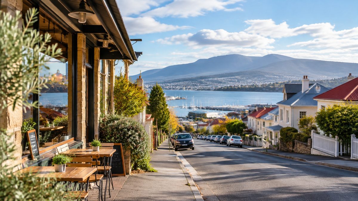
South Hobart is the clearest place to see Hobart change from a compact capital into a mountain settlement. The neighbourhood follows the Hobart Rivulet from the edge of the city towards the forest below kunanyi/Mount Wellington. Homes, shops, historic industrial sites and walking tracks sit along this narrow route. Understanding that line is the key to understanding the area.
The Suburb suits visitors who want local life within reach of central Hobart. It also appeals to residents who value older streets, nearby bushland and useful daily services. Yet the experience changes from one end to the other. The lower streets feel close to the city. The upper end feels greener, quieter and more connected to the mountain.
This South Hobart neighbourhood guide follows that change. It explains how the village, rivulet and mountain access fit together, then gives you a practical way to explore them.
What makes South Hobart feel different from central Hobart?
South Hobart sits immediately beyond the southern edge of the Hobart City Centre, but its shape is far less formal. The centre has broad civic spaces and a street grid built around offices, shops and the waterfront. South Hobart narrows into a valley beneath steep residential slopes.
Macquarie Street and Davey Street carry much of the road traffic between the city and southern districts. Away from those routes, the pace changes fast. Older cottages stand near later homes. Small businesses cluster around South Hobart Village. The Hobart Rivulet runs through a green corridor below many of the streets.
This layout creates several versions of the neighbourhood. Lower South Hobart works well for a quick walk from central Hobart. The village is the practical heart of the area. Farther west, the Cascade precinct marks the shift towards larger grounds, wooded slopes and the mountain road.
The result is a neighbourhood that makes most sense as a route rather than a single destination. Walk or travel from east to west and the change becomes easy to read.
Where is the neighbourhood’s useful centre?
South Hobart Village is the best point of reference for daily life. The local shopping strip sits along Macquarie Street, where residents can reach food, coffee and basic services without returning to the central business district.
The village is modest in scale. That is part of its value. It serves the surrounding homes instead of acting as a large visitor precinct. Morning foot traffic often reflects school trips, work journeys and local errands. Later in the day, road traffic can make the main street feel busier than its small size suggests.
Visitors should use the village as a pause between the city-facing and mountain-facing parts of South Hobart. It is a sensible place to buy food before walking the rivulet route. It also provides a useful meeting point because bus services use the main road and several local streets connect with the track corridor.
Do not judge the whole neighbourhood from Macquarie Street alone. The main road shows its practical side. The quieter streets and waterways reveal why the area feels distinct.
Why does the Hobart Rivulet explain the area so well?
The Hobart Rivulet is the physical thread running through South Hobart. Water flows from the slopes of kunanyi/Mount Wellington towards central Hobart and the River Derwent. The rivulet helped shape where industry developed because early businesses needed a dependable water source.
Today, the waterway offers a different benefit. Its banks form a green passage through developed land. Trees soften the nearby roads and houses, while small bridges reveal how often streets cross the channel. Some sections feel enclosed by vegetation even though homes are close.
The rivulet also explains why the neighbourhood cannot be understood from a standard street map alone. Roads follow the valley at one level. The water and shared path use another. A destination that looks close may require a bridge, side street or short climb to reach it.
After heavy rain, water levels can rise and track conditions can change. Stay behind barriers and follow closure signs. The rivulet is part of an active catchment, not a decorative urban stream.
How should you use the Hobart Rivulet Track?
The Hobart Rivulet Track gives walkers and cyclists a direct way to experience the neighbourhood’s defining corridor. It links the city side of the valley with the Cascade area while avoiding long stretches beside heavy road traffic.
The track is generally more useful than a random walk through residential streets. It reveals the waterway, industrial history and valley shape in one trip. Access points also let you leave the route for South Hobart Village or nearby historic places.
Shared use requires attention. Cyclists should slow near narrow sections, dogs and blind corners. Walkers should keep to one side and remain alert. Tree roots, damp surfaces and loose material can affect footing, especially after wet weather.
A hypothetical visitor staying near the waterfront could walk from the Hobart City Centre towards the lower rivulet, follow the track west, stop near Cascade Gardens and return by bus. That plan covers a meaningful stretch without turning the day into a steep mountain walk.
Allow more time than the distance alone suggests. Track entrances, interpretive details and short detours invite stops. The route also gains height as it moves towards the foothills.
What does the Cascade precinct add to a visit?
The Cascade precinct shows how water, industry and settlement developed together. Cascade Brewery stands near the upper end of the urban valley beneath wooded slopes. Its prominent historic building and long association with the area make it one of South Hobart’s clearest landmarks.
The brewery remains a working industrial site, so visitors should treat signed access limits seriously. Public experiences and opening arrangements can change. Check the operator’s current information before planning a tour or meal around it.
Across the road, Cascade Gardens offers public lawns and mature trees in a setting framed by the mountain. It works well as a rest point after the rivulet walk. The gardens also make the shift in scenery clear. Central Hobart feels close on a map, yet the wooded upper valley already dominates the view.
The precinct should not be reduced to a photo stop. Look at the position of the buildings beside the rivulet and below the mountain slopes. That relationship explains why major industry took root here.
Which historic place needs more time than most visitors allow?
The Cascades Female Factory Historic Site deserves a separate visit rather than a rushed detour. It formed part of the system used to confine and control transported women during the colonial period. The site is included within the Australian Convict Sites World Heritage property.
Much of its meaning comes from the surviving space, archaeology and interpretation rather than a complete set of intact buildings. Visitors expecting a furnished colonial house may miss the point. The walls and yards show how confinement worked through physical separation, labour and strict control.
Allow time to read the interpretation. The site deals with punishment, displacement and the lives of women whose records were often shaped by authorities. Its history should not be folded into a light brewery outing merely because both places share the Cascade name.
The location also reveals a harder side of the valley’s development. Productive land and flowing water supported industry, while the same area became part of a coercive colonial system. Holding both facts together gives a more honest account of South Hobart.
How does South Hobart connect with kunanyi/Mount Wellington?
South Hobart is a gateway to the lower slopes of kunanyi/Mount Wellington, though the urban neighbourhood does not extend to the summit. Roads rise through the upper valley towards bushland, Fern Tree, Tasmania and mountain access points.
Wellington Park begins where developed streets give way to protected natural land. The park contains a large network of walking tracks, changing vegetation and exposed alpine areas at higher elevations. Conditions near the summit can differ sharply from those in South Hobart.
This connection shapes the neighbourhood even when residents do not enter the park. The mountain affects shade, weather and views. Bushfire planning also matters along the urban edge. On days of severe fire danger or poor weather, official advice should guide any trip into the foothills.
Fern Tree, Tasmania is a separate settlement higher on the mountain road. It should not be treated as the upper part of South Hobart. Visitors often pass through the South Hobart corridor on the way there, but the two places offer different conditions and walking access.
If your main aim is Wellington Park, prepare for a bush outing rather than extending a casual neighbourhood stroll. Carry suitable clothing, check track status and confirm transport before leaving the urban area.
Is South Hobart practical without a car?
The lower neighbourhood and village are practical to reach on foot or by bus from central Hobart. The Hobart Rivulet Track also provides a useful off-road line through much of the valley. A car becomes more useful when the plan includes high mountain areas or several distant stops.
Walking has one clear limit: slope. Streets rise steeply away from the valley floor. A rental or home that appears close to the village may sit well above it. The downhill trip can feel easy, while the return takes more effort.
Bus services generally follow the main corridor, but routes and timetables can change. Check Metro Tasmania information on the day of travel. Evening and weekend frequency may shape how long you can stay near the upper end.
Cycling can work well along the shared track. Road sections demand more care because traffic is heavy on the main one-way routes. Riders should also plan for the gradual climb towards Cascade and the faster return towards the city.
Which part of South Hobart fits each kind of visit?
Choose the lower end if you want to combine South Hobart with the city in a short outing. This section keeps walking distances manageable and gives easy access to the lower rivulet corridor.
Choose the village if your main interest is neighbourhood life. It offers the best view of how residents use local shops and services. Nearby streets also show the mix of housing created across different stages of Hobart’s growth.
Choose the Cascade end for history and green space. The brewery precinct, Cascade Gardens and the Female Factory can fill several hours when visited with care.
Use South Hobart as a starting corridor if you plan to continue towards Fern Tree or Wellington Park. Do not assume that an urban bus trip and a mountain walk require the same gear.
For accommodation, check the exact position rather than relying on the suburb name. Distance from Macquarie Street, elevation and access to a bus stop can change the daily experience more than distance from the city on a map.
What details are easy to miss?
The neighbourhood’s industrial story extends beyond its best-known brewery. The rivulet supported work sites and water use along the valley. Even where structures have changed, the narrow land beside the water still shows why activity followed this route.
The area is also quieter only in parts. Main-road traffic can be loud, particularly near peak travel periods. A calm side street may sit one block from a busy route. This matters when selecting accommodation or deciding where to stop for a long break.
Public green space does not mean every wooded area is open for access. Some land near the rivulet or industrial precinct is private, fenced or environmentally sensitive. Follow marked paths.
South Hobart’s closeness to the city can also lead visitors to underestimate weather changes. The upper valley receives more shade, and damp track sections may remain cool after the city has warmed. A light extra layer can make a long walk more comfortable.
What is the best way to explore South Hobart in one day?
Build the day around the valley’s east-to-west story. This keeps the route clear and avoids repeated climbs.
- Begin near the city-facing end of the Hobart Rivulet Track and follow the water upstream.
- Leave the track near South Hobart Village for food and a look at the local shopping strip.
- Continue towards the Cascade precinct, allowing dedicated time for either the Cascades Female Factory Historic Site or a booked brewery experience.
- Finish at Cascade Gardens, then walk back downhill or use a confirmed bus service.
This plan is flexible without losing the main idea. If the weather turns wet, shorten the track section and spend more time at an indoor historic site. If conditions are clear, extend the riverside walk, but do not add a mountain route without separate preparation.
The Hobart Field Guide is an independent local publication. Use its Hobart guides to place this outing within a wider city visit.
Start at the Hobart Rivulet, follow it uphill through the village to Cascade, and let the changing valley explain South Hobart as you go.