Lenah Valley Neighbourhood Guide
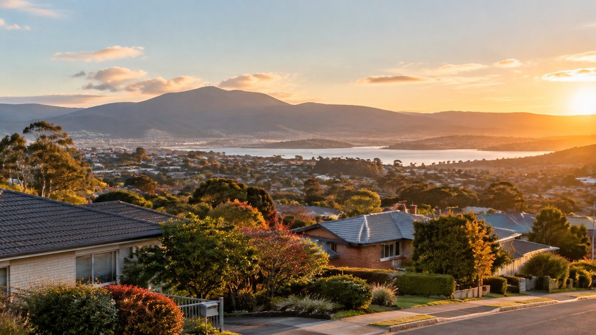
Lenah Valley is a practical Hobart suburb for people who want everyday services, established homes and quick access to the foothills of kunanyi/Mount Wellington. It sits close enough to central Hobart for regular trips into town, yet much of the neighbourhood feels separate from the inner-city grid. Its long valley shape explains almost everything about daily life here, from transport and shopping to weather and walking.
This Lenah Valley neighbourhood guide focuses on how the area works rather than treating it as a list of attractions. Lenah Valley is mainly residential. Its appeal lies in useful local shops, leafy streets and the way urban blocks rise towards bush-covered slopes. The best way to understand it is to look at the valley in sections, because the lower, central and upper parts offer different experiences.
How does the valley shape the neighbourhood?
Lenah Valley extends inland from the northern side of central Hobart towards Wellington Park. Augusta Road forms its main local spine before the route continues uphill through the valley. Side streets climb away from this corridor, sometimes gently and sometimes with enough force to make a short walk feel longer than expected.
The lower end has stronger links with New Town and the city. The middle section gathers many of the services used in daily life. Farther west, houses sit closer to the wooded edge of Wellington and the streets feel quieter. This change is gradual, so there is no single point where suburban Lenah Valley suddenly becomes foothill country.
Elevation matters when comparing addresses. A home that appears close to a bus stop or shop on a flat map may sit well above it. The climb back can affect older residents, families using prams and anyone carrying groceries. Buyers and renters should test the route on foot instead of judging distance by kilometres alone.
Where does Lenah Valley fit within Hobart?
Lenah Valley occupies a useful middle position between inner Hobart and the western foothills. New Town lies to the east, while Mount Stuart, Tasmania sits to the south across the ridges and connecting streets. West Moonah and Moonah, Tasmania are nearby to the north, although the terrain and road layout mean that two close points may require a less direct trip than expected.
This position gives residents access to several shopping areas without placing a major retail strip through the whole neighbourhood. Central Hobart remains the main destination for many jobs and services. Moonah adds larger shops, dining choices and links along the northern corridor. New Town provides further supermarkets, schools and health services nearby.
Lenah Valley feels less urban than many suburbs at a similar distance from the centre. Trees, sloping blocks and views towards the mountain soften the built area. At the same time, this remains an established Suburb rather than a semi-rural retreat. Traffic, school travel and limited parking near busy local services are part of normal life.
Which part of Lenah Valley suits your daily routine?
The lower section suits people who value easier access to New Town, North Hobart and central Hobart. Trips tend to be shorter, and some routes are less steep than those higher in the valley. The trade-off is a busier setting near through roads and intersections.
Central Lenah Valley is useful for households that want local services within reach. Augusta Road carries neighbourhood businesses and community facilities, although they are spread along the corridor rather than gathered into one large centre. Check the exact distance from a property to the places you expect to use each week.
Upper Lenah Valley suits residents who place more value on quiet streets, bush views and access towards Wellington Park. Blocks can feel sheltered and private. They can also be steeper, colder and more dependent on a car. Shade arrives earlier on some slopes during winter, which affects outdoor space and how quickly a home warms.
A hypothetical household with one city worker and one school-aged child may find the middle section most convenient because it reduces trips for basic errands. A keen trail user may accept a longer trip to the shops for a position closer to the foothills. The right section follows routine, not postcode prestige.
What can you find around Augusta Road?
Augusta Road is the clearest place to read the neighbourhood. It carries traffic through the valley while supporting small-scale shopping and local services. The mix changes from block to block, so visitors should not expect a continuous café or retail strip like the one found in North Hobart.
The road is useful because it connects residential pockets that would otherwise feel separate. Bus services use this broad corridor, and many side streets feed into it. Residents often plan errands around the businesses closest to their usual route rather than crossing the suburb for a single centre.
Traffic can become busy during school and work travel times. Driveways, parked cars and turning vehicles demand care. Noise also varies sharply between a house facing the main road and one around the corner. Anyone assessing a property should visit during the morning peak and again after dark.
Local businesses can change, so opening hours and services should be checked before a special trip. The lasting value of Augusta Road is its role as the neighbourhood's working spine, even when individual shopfronts change hands.
How easy is it to get around?
Driving gives residents the widest choice, especially in the upper valley. Main routes connect towards the city, New Town and the northern suburbs. Peak traffic can slow these trips, and narrow residential streets require patience where cars park on both sides.
Public buses serve the area, with the most useful stops generally found along the main corridor. Service frequency and operating hours differ by route and day. Check the current timetable against real commitments such as an early shift or evening class. A route that works at 8 am may be much less useful late at night.
Walking is practical for short local trips when the start and destination share a similar elevation. Cross-slope journeys can be harder. Footpaths are not uniform across every street, and steep grades can turn a simple return walk into a workout.
Cycling conditions also depend on the direction of travel. The downhill run towards central Hobart is easier than the ride home. Riders need confidence around traffic on connecting roads, while an electric bike can make the elevation more manageable. Secure storage at home matters because many properties rely on steps, narrow side access or sloping driveways.
What kind of housing is common?
Lenah Valley contains homes from several periods, with many detached houses on established blocks. Brick, weatherboard and rendered finishes all appear. Later infill has added units and townhouses in some pockets, but the suburb still reads as a low-rise residential area.
Slope creates both value and risk. Elevated blocks may gain broad views and good light. They may also have stairs, retaining walls and difficult vehicle access. Drainage deserves close attention because water moves downhill through the valley. A building inspection should assess the house as well as visible site features, including paths, subfloor areas and retaining structures.
Orientation can matter more than a polished interior. North-facing rooms may receive welcome winter sun, while homes tucked against a slope can remain cool. Large trees provide shade and character but may add maintenance, leaf build-up and branch risk. Tasmania's changing seasons expose these differences more clearly than a single inspection on a mild afternoon.
Older homes may have been extended in stages. Buyers should compare the visible building with approved records and seek professional advice where needed. Renovation access can also raise costs if materials must move along stairs or narrow driveways.
How close is the bush?
The upper valley reaches towards the lower slopes of kunanyi/Mount Wellington and Wellington Park. This gives parts of Lenah Valley a strong visual link with the mountain. Bush tracks and reserve connections may be close by, but access points, track grades and permitted uses differ.
Wellington Park is a managed natural area, not an extension of a suburban backyard. Conditions can change quickly with cold fronts, heavy rain, snow or fire danger. People heading onto tracks should check official alerts, take suitable clothing and choose a route that matches their ability.
Living near vegetation also brings household duties. Residents should understand bushfire planning, keep access clear and follow current advice from Tasmania Fire Service and local authorities. Wildlife, falling leaves and damp shaded ground are normal parts of the setting. The bush edge offers beauty, but it asks for more preparation than an inner-city block.
Mountain weather affects the wider suburb too. Cloud over Wellington can signal a sharp shift even when central Hobart remains bright. Upper streets may feel cooler or windier than lower ones on the same day.
What services matter most for residents?
Lenah Valley has schools, health facilities and neighbourhood businesses within or near its boundaries. Larger retail needs are often met in New Town, Moonah or central Hobart. This spread works well for people who plan errands around regular travel, but it can feel less convenient for someone expecting one walkable town centre.
Families should check enrolment zones directly with the relevant school because boundaries and intake rules can change. The closest campus is not always the assigned option. Travel conditions at drop-off time also deserve a test run.
Health access is one of the area's practical strengths, with medical services in the wider district and major care available elsewhere in Hobart. Yet distance alone does not confirm availability. Patients should check whether a clinic accepts new bookings and whether the required service is offered.
Internet access, mobile reception and delivery conditions should be tested at the exact property. Hills and building materials can affect signals. Steep driveways or hidden entrances may also change how easily couriers, tradespeople and removal vehicles can reach a home.
What do visitors often misunderstand?
The first mistake is treating Lenah Valley as a compact visitor precinct. It rewards people who want to understand a lived-in Hobart neighbourhood, see how the city meets the foothills or use it as a route towards nearby reserves. It is less suited to someone seeking a dense line of attractions.
The second mistake is ignoring elevation. A plan that links distant points on foot may spend more time on steep residential streets than at the intended stops. Choose one part of the valley and explore it closely.
Another mistake is assuming the neighbourhood offers direct access to every nearby place. Ridges shape road connections to Mount Stuart, Tasmania, West Moonah and Moonah, Tasmania. Check the actual route before setting out.
Visitors should also respect residential streets. Park without blocking driveways, keep noise low and avoid treating private access ways as track entrances. Official maps are the safest guide near the bush edge.
How should you assess Lenah Valley for yourself?
Start on Augusta Road to understand local services and traffic. Then move uphill through the section that matches your housing budget or reason for visiting. Notice the grade, afternoon shade and distance between useful stops.
If you are considering a move, repeat the trip during a weekday peak and on a cold evening. Test the walk from the nearest bus stop. Listen for road noise from inside the property, check how the driveway feels and look at where water would run during heavy rain.
Compare the neighbourhood with nearby New Town or West Moonah based on daily tasks rather than broad reputation. Lenah Valley offers a distinct mix of city access and foothill character, but the balance changes from street to street. The wider Hobart Field Guide can help place it within the rest of Hobart.
Actionable takeaway: choose one likely address, visit it at peak hour, then walk to the nearest shop or bus stop so the valley's slope, traffic and convenience become clear before you decide.