Maritime Museum Tasmania Visitor Guide
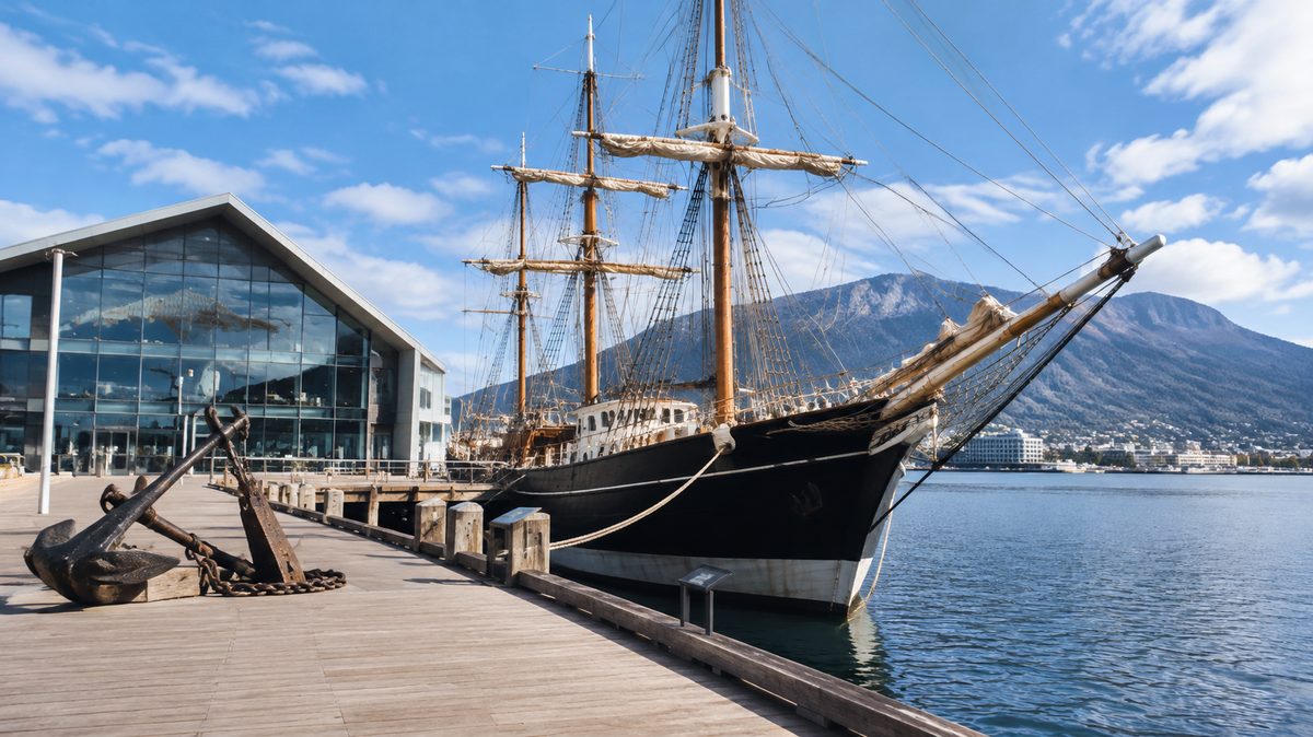
The Maritime Museum of Tasmania is a compact Hobart museum best visited before exploring the city’s working waterfront. Its displays explain how ships, ports and sea travel shaped Tasmania. Allow about 60 to 90 minutes inside, then use what you have learned to read the nearby docks, warehouses and harbour as parts of the same story.
The museum sits in the Carnegie Building on Argyle Street, close to Constitution Dock. It suits visitors who want more than a quick look at old ship models. The collection connects trade, migration, fishing, exploration and maritime disasters with the growth of Tasmania. This guide from The Hobart Field Guide, an independent publication, explains how to plan the visit and make sense of the displays without rushing through them.
What should you know before arriving?
Check the museum’s official website on the day you plan to visit. Opening hours, ticket prices and access arrangements can change. Public holidays and special events may also affect entry. The museum is indoors, so it works well on a wet or windy Hobart day, but its central location also makes it easy to include during a waterfront walk.
The building is within walking distance of central Hobart hotels, the waterfront and many bus stops. Drivers should allow time to find paid parking in the city centre. Parking close to the docks can fill quickly during markets, festivals and cruise ship visits.
Visitors with mobility needs should confirm lift access and any temporary gallery limits before setting out. Historic buildings can contain narrow passages or changes in floor level. Museum staff can advise on the easiest route through the collection.
You do not need specialist knowledge. A basic interest in Hobart or Tasmania is enough. The exhibits provide names, dates and technical detail, while the objects make the wider story clear. Taking a photo of any permitted gallery map can help you keep track of themes as you move between rooms.
How much time should you allow inside?
Allow 60 minutes for a focused visit and 90 minutes if you enjoy reading display panels. Maritime history enthusiasts may want two hours. The museum is relatively small, but models, maps and detailed objects reward slow viewing.
A rushed 30-minute visit can still work. Focus on the introductory displays, the sections on Hobart’s port and one subject that matches your interests. That might be Whaling, Shipbuilding or a major Shipwreck. Skip cases filled with small tools or technical parts unless they support the story you chose.
Families often move faster than solo visitors. Children may spend more time with ship models and navigation objects than with long text panels. Give them a simple task, such as finding how sailors located land or how cargo moved from a ship to shore. This turns the collection into a search rather than a reading exercise.
Which route makes the collection easier to understand?
Begin with Tasmania’s position as an island. The sea was a transport route, food source and barrier long before modern roads or regular air travel. Once that idea is clear, the rest of the museum fits into place.
Move next to navigation and coastal travel. Look for charts, instruments and models that show how crews entered shallow or unfamiliar waters. Tasmania’s coast includes exposed headlands, narrow approaches and reefs. Before electronic navigation, safe travel relied on charts, observation, local knowledge and careful estimates of position.
Continue into the trade and industry displays. These explain why ports developed where they did and what ships carried. Timber, food, people and manufactured goods moved through Tasmanian ports. The harbour was part of daily life rather than a scenic edge of town.
Finish with accidents, rescue and changing technology. By this point, a Shipwreck becomes more than a dramatic event. It shows what happened when weather, poor information, equipment failure or human judgement met a difficult coast. Ending here ties navigation, vessel design and working conditions together.
What do the ship models reveal?
Ship models are easier to understand when you treat them as working diagrams. Start with the hull. Its depth and shape suggest whether a vessel was built for cargo, speed, shallow water or long ocean travel. Then inspect the deck. Hatches, cranes, masts and deck space reveal the work performed on board.
Rigging can look like decoration, but each line had a purpose. Sailors used ropes and pulleys to control sails under load. A change in rig could affect crew size, handling and performance in rough conditions. Steam vessels replaced much of this work with engines, fuel storage and machinery, creating a different set of risks.
Compare models from different periods rather than studying each one alone. Changes in hull material, propulsion and deck layout show how maritime work developed. This makes Shipbuilding easier to grasp because you can see how builders responded to local routes, available materials and commercial needs.
Why does shipbuilding matter to Tasmania’s story?
Shipbuilding supported settlement, trade and travel between coastal communities. Tasmania had useful timber and workers who adapted overseas methods to local needs. Small craft served rivers and sheltered bays, while larger vessels carried goods beyond the island.
Look for tools, plans or half-hull models. Builders used half-hulls to develop a vessel’s shape before preparing full construction drawings. Hand tools also reveal the skill needed to turn heavy timber into curved frames and watertight planking.
The key question is what the vessel was built to do. A fishing boat needed a practical working deck. A cargo vessel needed capacity and stable handling. A fast passenger craft placed more value on speed. Form followed the job, available money and the conditions the vessel would face.
How should you read the whaling displays?
Whaling should be read as an industry with severe costs, not as a simple tale of adventure. Whale oil and related products once had high commercial value. Ships left port for long voyages, while shore stations processed animals caught closer to land.
Pay attention to equipment and working methods. Small boats placed crews close to large animals in dangerous seas. The work exposed people to injury, cold and exhaustion. It also caused heavy losses among whale populations.
The displays make more sense when viewed beside modern Hobart’s relationship with whales. Animals once pursued for profit are now protected and watched from the coast or on regulated tours. That change shows how economic demand, science and public values can alter the way people use the sea.
What can maritime archaeology tell us?
Maritime archaeology studies physical evidence connected with human life on or beside water. That evidence can include wrecks, anchors, harbour structures, cargo and objects recovered from submerged sites. Researchers record where items are found because their position can reveal how a vessel broke apart or how a harbour was used.
A corroded fitting may look minor in a display case. Its material and location can still help identify a vessel or explain a failure. Cargo can show trading links. Personal objects can reveal who travelled aboard and how they lived.
Removal without proper recording destroys much of this evidence. Visitors should never take objects from a wreck site. In Tasmania, heritage rules may protect wrecks and associated material. Report an apparent discovery to the relevant heritage authority instead of moving it.
How do shipwreck stories avoid becoming simple disaster tales?
A good Shipwreck display explains cause, setting and consequence. Read the chart first. Note the vessel’s intended route, nearby hazards and available ports. Then examine weather information, navigation methods and the ship’s design.
Ask what the crew knew at each stage. Modern visitors know how the event ended, but the people aboard did not. They may have worked with limited forecasts, uncertain charts or delayed communication. That gap explains many decisions that appear strange in hindsight.
Survival accounts also show how rescue systems changed. Lighthouses, radio, trained crews and better charts reduced some risks, though they never removed danger from the sea. The most useful lesson is rarely that one person made one mistake. Maritime accidents often grow from several small failures that meet at the wrong time.
Where do naval warfare and Port Arthur fit?
Naval warfare appears within a wider story of defence, shipping and control of sea routes. Tasmania’s ports connected the island to regional trade and military networks. War could change which ships entered port, what cargo they carried and how coastal areas were watched.
Do not expect a full military museum. Use relevant objects to understand how conflict affected civilian ports and merchant shipping. Uniforms, weapons, models or documents may explain service at sea, harbour protection or the movement of supplies.
Port Arthur, Tasmania adds another maritime link. The former penal station depended on sea transport for people, orders and goods. Its position on the Tasman Peninsula helped authorities control movement, though the surrounding water also created practical transport needs. Visitors planning both places can use the Hobart museum for broad context, then examine the specific penal and coastal setting at Port Arthur.
Why does Bass Strait deserve close attention?
Bass Strait separates Tasmania from mainland Australia and links major shipping routes. It can produce difficult conditions due to wind, waves, currents and rapidly changing weather. Crossing it required sound vessels, skilled crews and careful planning.
Displays linked to Bass Strait may cover passenger travel, cargo services, fishing or wrecks. Read them as parts of one transport problem: how to keep an island connected across exposed water. Regular sea links carried essential goods and made travel possible before air services became common.
Bass Strait also helps explain why Tasmanian maritime history is national rather than purely local. Ships entering Hobart were part of routes joining ports around Australia and beyond. Decisions made far from Tasmania could affect work, prices and supplies on the island.
What should families look for?
Start with scale and movement. Ask children to compare a model ship with the size of its crew or cargo. Let them find where people slept, steered or worked. These concrete questions make an unfamiliar vessel easier to picture.
Maps offer another useful entry point. Trace a route from Hobart through Bass Strait or around the Tasman Peninsula. Ask where a ship could shelter and which parts of the coast look exposed. Older children can compare the chart with a modern map on a phone after leaving the gallery.
Keep the visit short enough to preserve interest. Forty-five focused minutes can be better than a slow tour of every case. Choose two themes before entering and let each child select one object to discuss outside.
How does the museum change what you see at Constitution Dock?
Walk to Constitution Dock after the museum. It takes only a few minutes, and the transition from gallery to harbour makes the visit far more useful. Look at how vessels sit in the water, where ropes hold them and how people move between shore and deck.
The dock remains part of a working waterfront. Fishing boats, service areas and modern harbour equipment show that maritime history did not stop when sail gave way to engines. Respect barriers and active work zones. Wet surfaces, ropes and moving vehicles can create hazards.
Notice the sheltered water and the route out into the River Derwent. The museum’s charts and models should help you see why harbour shape matters. A port needs access, protection and enough depth for the vessels that use it.
Can you combine the museum with Salamanca Place?
Yes. A walk from the museum past Constitution Dock to Salamanca Place creates a clear link between sea transport and the warehouses built beside the port. The sandstone buildings at Salamanca stored goods when the waterfront served a more direct commercial role.
Allow extra time on Saturday because Salamanca Market changes pedestrian flow and parking demand. The market can make the area lively, but it can also distract from the physical clues in the buildings and streets. On a quieter day, it is easier to study loading access, warehouse scale and the short distance between storage and water.
This pairing works because each place answers a different question. The museum explains ships and maritime work. The waterfront shows where that work met the city.
What mistakes weaken the visit?
- Reading every label in order: Choose a theme first, then use other displays to support it.
- Treating models as ornaments: Inspect hull shape, deck layout and rigging to understand the vessel’s job.
- Skipping the real waterfront: Constitution Dock turns indoor facts into visible features.
- Assuming old methods were careless: Judge decisions using the tools and information available at the time.
- Taking wreck material: Leave possible archaeological finds where they are and report them properly.
What should you do before you go?
- Confirm current opening hours, admission prices and access details with the museum.
- Allow at least 60 minutes inside.
- Choose one main theme, such as Shipbuilding or maritime archaeology.
- Plan a short walk through Constitution Dock after the galleries.
- Continue to Salamanca Place if you want to see how shipping shaped nearby commercial buildings.
Book enough time for the museum and Constitution Dock together, because the collection becomes clearest when you step outside and read Hobart’s waterfront with fresh eyes.